Connecticut AT Day 2 (4/17/22)
Day 2 was even earlier than Day 1. I woke up at about 5 AM, and I was on trail at 6:05 AM. I didn't even need to set an alarm; I knew that I would be up on time. The plan called for a 26 mile day, so an early start was a must.
The first few miles were easy wandering along the Housatonic River. I came across some signs saying that the Housatonic should not be used as a water source, and I thought to myself that would have been useful information to post at the shelter. Thankfully, I didn't drink from it anyhow. I got my water from a feeder stream running into the Housatonic. I would assume that the Housatonic is probably polluted and that's the reason it's unsafe. I seem to remember seeing a sign that said something like that in Great Barrington last year.
Regardless, the first few miles of the hike went well. The trail was wet from the rain last night, but beyond that it was a pretty morning. There was a fog hanging over the river, and that led to some fantastic photo opportunities.

This photo was the first real glimpse I got of the sun.

The wildlife were out and about, especially the geese. At one point I heard something that sounded like two angry geese fighting with each other down on the river, but I couldn't see them through the fog. I also saw this object on a tree, and I couldn't figure out what it was. I thought maybe a nest of some type, perhaps for wasps or something, but I really don't know.

I also saw this tower off in the distance across a field. I wonder if it came from a settlement that existed in the area before it became a conservation area?

My first serious ascent of the day was Silver Hill. It was rocky, but I managed it without too much difficulty. I did think it was funny that right as I crested the hill, my phone decided to play "On Top of the World" by Imagine Dragons. Sort of appropriate, but then again Silver Hill isn't exactly Washington or Katahdin.
At this point, I was making pretty good time for the day and I was feeling like I would meet my timing goals. Then, I wound up at Guinea Brook. The trail crossed a road and descended down a hill to a water crossing called Guinea Brook. I looked at the water and there was definitely no way to rock hop across. I thought about fording, but the water was rushing pretty good, and deep enough to potentially be a problem if I got knocked off my feet.
My brain went to two places. Half of my brain said, "Yeah, you can do this, and you don't want to lose the time for having to find a way around, given your tight schedule." The other half of my brain, which sounded suspiciously like Dragonfly, said, "Don't do anything stupid and get yourself hurt, Hawk." I decided to listen to the Dragonfly half of my brain. I headed back up to the road.
There was a blue blaze trail around Guinea Brook, but it required two road walks. The first was on the main road, and it wasn't really designed for pedestrians, having narrow shoulders. It was almost entirely downhill. The second was on a dirt road, and it was almost entirely uphill. Remember what I said yesterday about dirt roads usually being well-graded? Not this one. It was quite steep. All in all, the workaround ended up adding about a mile to the length of my hike and five hundred feet to my total elevation gain. It also put me solidly behind schedule.
As if Guinea Brook wasn't bad enough, now for some reason Mother Nature decided that she was mad at me. Every time that I prepared to hike up a mountain, the sun would come out, the wind would die down, and the temperature would soar. Then, when I went over the top and started to descend the mountain, the sun would go away, the wind would pick up, and the temperature would drop. I had to constantly stop and take my jacket on or off. This happened on five consecutive climbs. After a while, there wasn't much that I could do but laugh at the absurdity of it.
Then, as if to add insult to injury, snow squalls started up. The forecast had shown no precipitation at all, so this caught me a bit by surprise. There were seven of them in total, of varying severity. It would be bright and sunny one minute, and then snowy and windy the next. The worst one will get its own section a little later in the blog.
One cool thing that I encountered was a formation called Roger's Ramp. This was two boulders close together, with some rocks in between them to use as steps. It wasn't quite tight enough to have to take your pack off to fit through, but it was tight. I always enjoy unique terrain like that, so I had fun with it.

Of the mountains that I went over, one of them was perfectly named. It was called Mount Easter. I don't know why it was called that, but I thought it was pretty cool to be hiking over Mount Easter on Easter Sunday.
In one gully I hiked into, I met an older guy with an AT hat on. He was sitting there eating his lunch, and we chatted for a minute or two. Based on the AT hat, I would assume that he had done some trail volunteering or something like that at some point. He asked me about my plans for the day, and I told him that I was trying to do what was now a 27 mile day. He told me that he planned to do 6 miles. It just really goes to show that the AT is there for all types of hikers, no matter how ambitious your plans.
As I hiked along, I found a tree that appeared as if it had been torn down by a vine. I suspect that what actually happened was that the tree fell and then the vine wrapped around it later, but it was still a weird visual.

Descending the first ridge of the day, I heard a shotgun blast. Then, a couple minutes later, I heard another one. I quickened my pace a little bit to get off the mountain. I don't even know what hunting season is currently going on in Connecticut, but my general rule is to try to avoid running into people with guns in the woods (or anywhere, really) if doing so is at all possible.
Once I got down the ridge, I entered into a developed area around Housatonic Valley Regional High School. Almost as soon as I stepped out of tree cover, the biggest snow squall of the day began. Snow is not actually an accurate term, as I was getting pelted by sleet. The wind was howling, and it was all I could do to try to keep my hood in place for some measure of protection. I was jealous of the people driving by in the warmth of their cars.
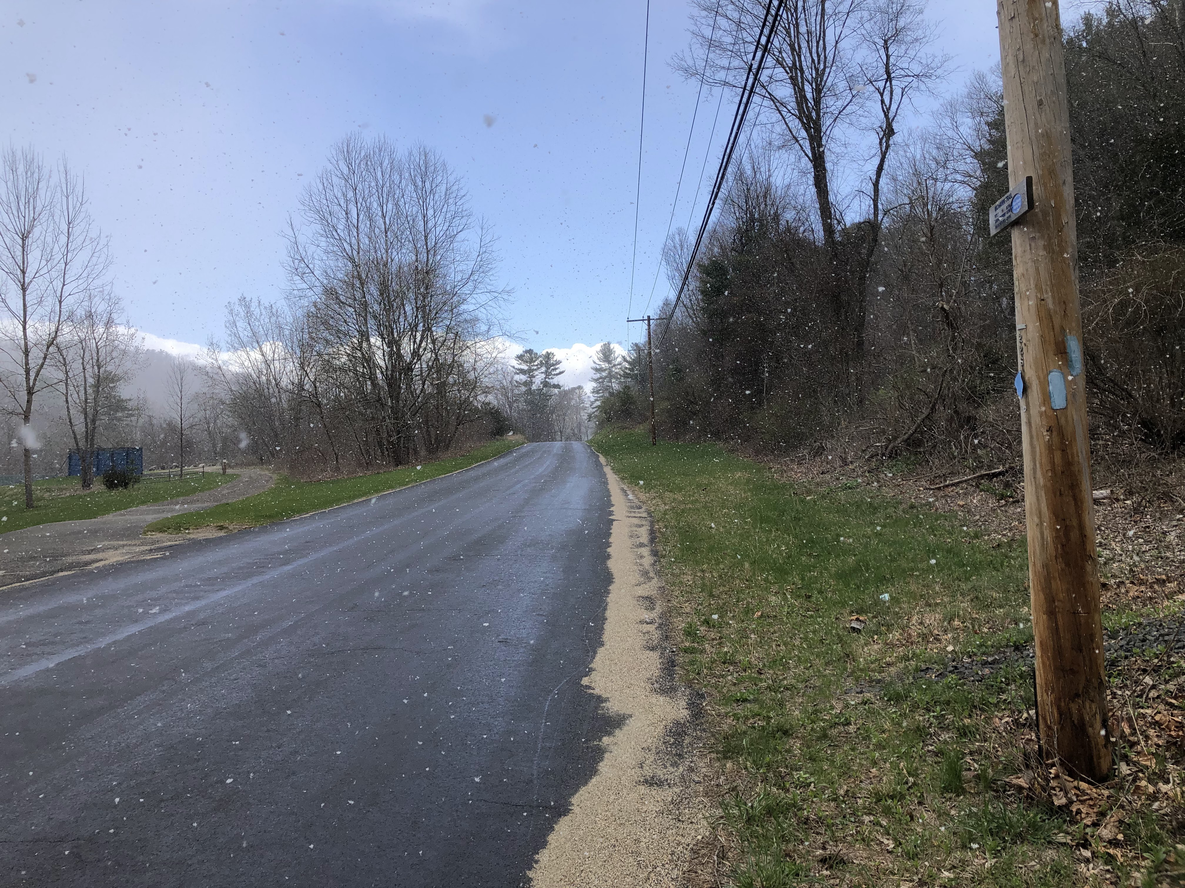
I came to a road intersection with a traffic light. Whoever marked the trail in that area had helpfully put AT markers on three of the corners, so that it wasn't clear at all where the trail went. Normally, I would have pulled up FarOut on my phone, but with the conditions, using the phone wasn't really possible. I knew that the trail went in front of the high school, so I headed in that direction. Thankfully, I soon saw more trail markers. I proceeded down the road past the high school, and as I did the storm lessened. Soon, there was blue sky again, but still big snowflakes falling. They were those pretty kind of snow globe snowflakes, and I got a couple pictures of them before re-entering the woods. You'll have to click on the picture to really see the flakes.
Not far into the woods, I crossed a dry stream. Normally that wouldn't be notable, but I thought it was strange that this stream would be dry when every other stream I had seen was roaring with the spring melt and the recent rains. Something had to have shifted that made the stream permanently dry.
The trail next entered a woody area next to the Housatonic for a while, and this was a beautiful piece of trail. It was so nice, in fact, that there were actually signs up showing that the trail was wheelchair accessible. It has to be the first part of the Appalachian Trail that I have seen that is wheelchair accessible.
As if to emphasize what a family friendly area it was, I found a few logs where little kids had used sidewalk chalk to decorate the logs. Given the rain the previous night, I would imagine that the kids had to have been there recently, probably earlier the same day.

My last big ascent of the day would start from Falls Village, Connecticut. There, the AT wound itself around a big waterfall called Great Falls. As I ascended towards it, I ran into a guy standing there admiring it. He explained that he had been through Falls Village many times before, but had never taken the time to stop and see the waterfall itself. We chatted for a few minutes, and he told me that his daughter, his niece, and one of their friends had just started hiking the Pacific Crest Trail, or PCT. As I took my leave to continue my climb, I wished his daughter and her friends good luck on the PCT. That's a seriously ambitious hike.

The trail ascended up Mount Prospect. It was tough on my legs, given that they already had twenty plus miles on them at this point, but outside of that context it wasn't an especially difficult mountain. There were some fantastic views from the ridge, and I passed the 1,500 mile marker for the Appalachian Trail northbound. I do wonder a little about how accurate those markings are, given how often the trail is re-routed, though.

The end of day plan was to meet up with Dragonfly's brother-in-law, Ben, who I was going to be hiking with for the next two days. However, it was hard to nail down when exactly the hike was going to finish. My original estimate was at about 6 PM, but then I had to push it back to 7 PM after the incident at Guinea Brook. However, I knew that I would speed up as the day went on and the terrain got easier. I was able to push my estimate back to 6:30 PM. Thus, at about 6 PM, Ben parked in the Appalachian Trail parking lot at Undermountain Road and started hiking south to meet up with me. Unfortunately for him, I had picked up significant speed at this point, and I ended up meeting him when he had hiked about 200 feet. I finished the hike at about 6:03. Thus, I had done 27 miles in 12 hours, so not a bad pace overall.
Ben drove me back to the Interlaken Inn, which was a fantastic place to stay. They had their own attached restaurant, where we had fettuccine with real tomato sauce, eggplant, and spinach for dinner. It was a heck of a lot better than the usual hiker food of pizza. The room was comfortable, and the hotel grounds were beautiful. I really enjoyed my shower, as one would expect.
I helped Ben set his pack up for the next two days of hiking, and I organized my pack. Ben had brought me two days of food that I had previously given to him for safekeeping. I organized these into my pack so that I would be ready for the next day. I dried my clothes out the best I could. I was fairly sore after the long day, but I was confident that I would be ready to go for the next day.
Always remember, you can't take flight until you spread your wings!


Mt. Easter was originally known as Cadbury Mountain. But in 1972 somebunny petitioned that it be called something less brand-specific.
ReplyDelete27 miles in one day?!! I am always amazed by how much you are able to pack into a day. There seems to never be a dull moment/always interesting happenings along the way.
ReplyDelete